Abel Tasman: Difference between revisions
imported>Keith D Remove unknown parameter |
Spelling mistake |
||
| Line 4: | Line 4: | ||
{{Use British English|date=August 2024}} | {{Use British English|date=August 2024}} | ||
{{Infobox person | {{Infobox person | ||
| image = Abel Tasman | | image = Abel Tasman - Cuyp (cropped) (adjusted).jpg | ||
| caption = | | caption = Portrait of Tasman, {{circa}} 17th century | ||
| birth_date = {{birth year|1603}} | | birth_date = {{birth year|1603}} | ||
| birth_place = [[Lutjegast]], [[Dutch Republic]] | | birth_place = [[Lutjegast]], [[Dutch Republic]] | ||
| Line 18: | Line 18: | ||
}} | }} | ||
[[File:Tasmanroutes.PNG|thumb|upright=1.3|Routes taken by Tasman in the Australasian region, on his first and second voyages]] | [[File:Tasmanroutes.PNG|thumb|upright=1.3|Routes taken by Tasman in the Australasian region, on his first and second voyages]] | ||
'''Abel Janszoon Tasman''' ({{IPA|nl|ˈaːbəl | '''Abel Janszoon Tasman''' ({{IPA|nl|ˈaːbəl ˈjɑnszoːn ˈtɑsmɑn|lang}}; 1603{{snd}}10 October 1659) was a Dutch [[sea explorer|seafarer]] and [[exploration|explorer]], best known for his voyages of 1642 and 1644 in the service of the [[Dutch East India Company]] (VOC). He was the first European to reach [[New Zealand]], which he named ''Staten Landt''. He was also the eponym of [[Tasmania]]. | ||
Likely born in 1602 or 1603<ref name=teara/> in [[Lutjegast]], Netherlands, Tasman started his career as a [[merchant]] seaman and became a skilled [[navigator]]. In 1633, he joined the VOC and sailed to [[Batavia, Dutch East Indies|Batavia]], now Jakarta, Indonesia. He participated in several voyages, including one to Japan. In 1642, Tasman was appointed by the VOC to lead an expedition to explore the uncharted regions of the [[Southern Pacific Ocean]]. His mission was to discover new trade routes and to establish trade relations with the native inhabitants. After leaving Batavia, Tasman sailed westward to Mauritius, then south to the [[Roaring Forties]], then eastward, and reached the coast of Tasmania, which he named [[Van Diemen's Land]] after his patron, [[Anthony van Diemen]]. He then sailed north east, and was the first European to discover the west coast of New Zealand, which he named ''Staten Landt''. It was later renamed ''Nieuw Zeeland'', after the Dutch province of [[Zeeland]], by [[Joan Blaeu]], official Dutch cartographer to the Dutch East India Company.<ref name=teara/> | Likely born in 1602 or 1603<ref name=teara/> in [[Lutjegast]], Netherlands, Tasman started his career as a [[merchant]] seaman and became a skilled [[navigator]]. In 1633, he joined the VOC and sailed to [[Batavia, Dutch East Indies|Batavia]], now Jakarta, Indonesia. He participated in several voyages, including one to Japan. In 1642, Tasman was appointed by the VOC to lead an expedition to explore the uncharted regions of the [[Southern Pacific Ocean]]. His mission was to discover new trade routes and to establish trade relations with the native inhabitants. After leaving Batavia, Tasman sailed westward to Mauritius, then south to the [[Roaring Forties]], then eastward, and reached the coast of Tasmania, which he named [[Van Diemen's Land]] after his patron, [[Anthony van Diemen]]. He then sailed north east, and was the first European to discover the west coast of New Zealand, which he named ''Staten Landt''. It was later renamed ''Nieuw Zeeland'', after the Dutch province of [[Zeeland]], by [[Joan Blaeu]], official Dutch cartographer to the Dutch East India Company.<ref name=teara/> | ||
Despite his achievements, Tasman's expedition was not entirely successful. The encounter with the [[Māori people]] on the [[South Island]] of New Zealand resulted in a violent confrontation, which left four of Tasman's men dead. He returned to Batavia without having made any significant contact with the native inhabitants or establishing any trade relations. | Despite his achievements, Tasman's expedition was not entirely successful. The encounter with the [[Māori people]] on the [[South Island]] of New Zealand resulted in a violent confrontation, which left four of Tasman's men dead. He returned to Batavia without having made any significant contact with the native inhabitants or establishing any trade relations. Tasman continued to serve the Dutch East India Company until his death in 1659. | ||
More than a century later, knowledge from Tasman's expeditions was [[First voyage of James Cook|used by James Cook]], leading to exploration and colonization of Australia and New Zealand by the British. | |||
==Biography== | ==Biography== | ||
| Line 31: | Line 33: | ||
Uneducated, but employed by the [[Dutch East India Company]] (VOC), Tasman learned navigation and seamanship on the job. In 1634, he was appointed skipper of the ''Mocha'', and, under the command of Frans Valck, he went on a two-year voyage to the [[Maluku Islands]].<ref name=nzgeo>{{Cite news | url=https://www.nzgeo.com/stories/abel-tasman/ | title=Abel Tasman | first=Vaughan | last=Yarwood | work=[[New Zealand Geographic]] | date=March 2005}}</ref> | Uneducated, but employed by the [[Dutch East India Company]] (VOC), Tasman learned navigation and seamanship on the job. In 1634, he was appointed skipper of the ''Mocha'', and, under the command of Frans Valck, he went on a two-year voyage to the [[Maluku Islands]].<ref name=nzgeo>{{Cite news | url=https://www.nzgeo.com/stories/abel-tasman/ | title=Abel Tasman | first=Vaughan | last=Yarwood | work=[[New Zealand Geographic]] | date=March 2005}}</ref> | ||
Tasman sailed from [[Texel]] | In 1633, Tasman sailed from [[Texel]] in the [[Netherlands]] to [[Batavia, Dutch East Indies|Batavia]] (now [[Jakarta]]), using the southern [[Brouwer Route]]. While based in Batavia, he later joined a voyage to [[Seram Island]], in what is now Indonesia’s [[Maluku Islands|Maluku Province]]. The expedition was sent after local traders sold spices to European merchants other than the [[Dutch East India Company|Dutch]]. | ||
Tasman docked to find wood for repairs and was separated from the other ships; a fight broke out with local villagers and at least two of Tasman's men were killed.<ref name=nzgeo/><ref name=dictionary>{{Cite Australian Dictionary of Biography |id2=tasman-abel-janszoon-2716 |title=Abel Janszoon Tasman (1603–1659) |first=J. W. |last=Forsyth |year=1967 |volume=2 |archive-date=30 July 2016 |archive-url=https://web.archive.org/web/20160730105650/http://adb.anu.edu.au/biography/tasman-abel-janszoon-2716 |url-status= | Tasman docked to find wood for repairs and was separated from the other ships; a fight broke out with local villagers and at least two of Tasman's men were killed.<ref name=nzgeo/><ref name=dictionary>{{Cite Australian Dictionary of Biography |id2=tasman-abel-janszoon-2716 |title=Abel Janszoon Tasman (1603–1659) |first=J. W. |last=Forsyth |year=1967 |volume=2 |archive-date=30 July 2016 |url=http://adb.anu.edu.au/biography/tasman-abel-janszoon-2716 |archive-url=https://web.archive.org/web/20160730105650/http://adb.anu.edu.au/biography/tasman-abel-janszoon-2716 |url-status=dead}}</ref> | ||
By August 1637, Tasman had returned to Amsterdam, and in 1638 he signed on for another ten years and took his wife with him to Batavia via a six-month journey.<ref name=dictionary/> On 25 March 1638, he tried to sell his property in the Jordaan, but the purchase was cancelled.<!--; in 1650, while living in the East Indies, it was sold to the same man.<ref>[http://stadsarchief.amsterdam.nl/archieven/archiefbank/indexen/transportakten_voor_1811/zoek/query.nl.pl?i1=1&v1=Abel&a1=Tas*&i2=2&p2=p&y2=1620&z2=1660&x=14&z=a City Archives Amsterdam ]</ref>--> | By August 1637, Tasman had returned to Amsterdam, and in 1638 he signed on for another ten years and took his wife with him to Batavia via a six-month journey.<ref name=dictionary/> On 25 March 1638, he tried to sell his property in the Jordaan, but the purchase was cancelled.<!--; in 1650, while living in the East Indies, it was sold to the same man.<ref>[http://stadsarchief.amsterdam.nl/archieven/archiefbank/indexen/transportakten_voor_1811/zoek/query.nl.pl?i1=1&v1=Abel&a1=Tas*&i2=2&p2=p&y2=1620&z2=1660&x=14&z=a City Archives Amsterdam ]</ref>--> | ||
| Line 46: | Line 48: | ||
The expedition was to use two small ships, ''[[Heemskerck (1638 ship)|Heemskerck]]'' and ''Zeehaen''. | The expedition was to use two small ships, ''[[Heemskerck (1638 ship)|Heemskerck]]'' and ''Zeehaen''. | ||
====Mauritius==== | ==== Mauritius ==== | ||
Tasman sailed from [[Batavia, Dutch East Indies|Batavia]] on 14 August 1642<ref name="robinsonlibrary">{{cite web|url=http://www.robinsonlibrary.com/geography/geography/discoveries/tasman.htm|title=Abel Janszoon Tasman, the first known European explorer to reach Tasmania and New Zealand and to sight Fiji|publisher=robinsonlibrary.com|access-date=31 August 2015|archive-date=24 September 2015|archive-url=https://web.archive.org/web/20150924091636/http://www.robinsonlibrary.com/geography/geography/discoveries/tasman.htm|url-status=usurped}}</ref> and reached [[Mauritius]] 22 days later, on 5 September 1642, according to the captain's journal.<ref name="abeltasman.org" /> On the island there was fresh water, timber for repairs, and the crew could be well fed. Tasman also received assistance from the governor, [[Adriaan van der Stel]]. | |||
Mauritius was chosen as a turning point because of the prevailing winds. After staying just over four weeks, the two ships, ''Heemskerck'' and ''Zeehaen'', left on 8 October and entered the [[Roaring Forties]] to make a fast eastward crossing. At the time, no expedition had sailed this far east. [[Pieter Nuyts]] had come closest, reaching a similar point about 15 years earlier, in 1626–27. | |||
On 7 November, nearly a month into the crossing, snow and hail forced the ship's council to change course to the north-east,<ref name="abeltasman.org" /> aiming instead for the [[Solomon Islands]]. | |||
====Tasmania==== | ====Tasmania==== | ||
[[File:Abel Tasman Tasmania 1642 SLNSW FL3174899.jpg|thumb|Coastal drawings of Tasmania, Huijdecoper journal of Abel Tasman, Hessel Gerritsz, 1642]] | |||
[[File:Coastal-cliffs Tasman-peninsula.jpg|thumb|Coastal cliffs of [[Tasman Peninsula]]]] | [[File:Coastal-cliffs Tasman-peninsula.jpg|thumb|Coastal cliffs of [[Tasman Peninsula]]]] | ||
On 24 November 1642, Tasman reached and sighted the west coast of [[Tasmania]], north of [[Macquarie Harbour]].<ref name="nla">{{cite web |url=http://nla.gov.au/nla.map-ra265-s97 |title= Monumenta cartographica [cartographic material] : reproductions of unique and rare maps, plans and views in the actual size of the originals : accompanied by cartographical monographs {{pipe}} Original map of Tasmania in December 1642 |via=National Library of Australia |access-date=31 August 2015 |archive-date=29 June 2011 |archive-url=https://web.archive.org/web/20110629165059/http://nla.gov.au/nla.map-ra265-s97 |url-status=live }}</ref> He named his discovery Van Diemen's Land, after [[Antonio van Diemen]], [[Governor-General of the Dutch East Indies]]. | On 24 November 1642, Tasman reached and sighted the west coast of [[Tasmania]], north of [[Macquarie Harbour]].<ref name="nla">{{cite web |url=http://nla.gov.au/nla.map-ra265-s97 |title= Monumenta cartographica [cartographic material] : reproductions of unique and rare maps, plans and views in the actual size of the originals : accompanied by cartographical monographs {{pipe}} Original map of Tasmania in December 1642 |via=National Library of Australia |access-date=31 August 2015 |archive-date=29 June 2011 |archive-url=https://web.archive.org/web/20110629165059/http://nla.gov.au/nla.map-ra265-s97 |url-status=live }}</ref> He named his discovery Van Diemen's Land, after [[Antonio van Diemen]], [[Governor-General of the Dutch East Indies]]. | ||
He tried to work his two ships into [[Adventure Bay, Tasmania|Adventure Bay]] on the east coast of [[South Bruny Island]], but he was blown out to sea by a storm. This area he named [[Storm Bay]]. Two days later, on 1 December, Tasman anchored to the north of Cape Frederick Hendrick just north of the [[Forestier Peninsula]]. On 2 December, two ship's boats under the command of the Pilot, Major Visscher, rowed through the Marion Narrows into Blackman Bay, and then west to the outflow of Boomer Creek where they gathered some edible "greens".<ref>Burney, J (1813) ''A Chronological History of the Voyage and Discoveries in the South Sea of Pacific Ocean'' L Hansard & Sons, London, p. 70, cited in Potts, B.M. et al. (2006) ''Janet Sommerville's Botanical History of Tasmania'' University of Tasmania and TMAG</ref> Tasman named the bay, Frederick Hendrik Bay, which included the present North Bay, [[Marion Bay, Tasmania|Marion Bay]] and what is now Blackman Bay. (Tasman's original naming, Frederick Henrick Bay, was mistakenly transferred to its present location by [[Marc-Joseph Marion du Fresne|Marion Dufresne]] in 1772). Tasman formally claimed the land on 3 December 1642.{{sfn|Beazley|1911}} | |||
For two more days, he continued to follow the east coast northward to see how far it went. When the land veered to the north-west at [[Eddystone Point]],<ref>{{cite book |last1=Schilder |first1=Günter |title=Australia unveiled : the share of the Dutch navigators in the discovery of Australia |date=1976 |publisher=Theatrum Orbis Terrarum Ltd. |location=Amsterdam |isbn=9022199975 |page=170}}</ref> he tried to follow the coast line but his ships were suddenly hit by the [[Roaring Forties]] howling through Bass Strait.<ref>{{cite book |last1=Valentyn |first1=Francois |title=Oud en nieuw Oost-Indien |orig-date=1724–1726 |date=2003|publisher=J. van Braam |location=Dordrecht |isbn=9789051942347 |page=vol. 3, p. 47}}</ref> Tasman was on a mission to find the Southern Continent not more islands, so he abruptly turned away to the east and continued his continent-hunting.<ref>{{cite book |last1=Cameron-Ash |first1=M. |title=Lying for the Admiralty |date=2018 |publisher=Rosenberg |location=Sydney |isbn=9780648043966 |page=105}}</ref> | For two more days, he continued to follow the east coast northward to see how far it went. When the land veered to the north-west at [[Eddystone Point]],<ref>{{cite book |last1=Schilder |first1=Günter |title=Australia unveiled : the share of the Dutch navigators in the discovery of Australia |date=1976 |publisher=Theatrum Orbis Terrarum Ltd. |location=Amsterdam |isbn=9022199975 |page=170}}</ref> he tried to follow the coast line but his ships were suddenly hit by the [[Roaring Forties]] howling through Bass Strait.<ref>{{cite book |last1=Valentyn |first1=Francois |title=Oud en nieuw Oost-Indien |orig-date=1724–1726 |date=2003|publisher=J. van Braam |location=Dordrecht |isbn=9789051942347 |page=vol. 3, p. 47}}</ref> Tasman was on a mission to find the Southern Continent not more islands, so he abruptly turned away to the east and continued his continent-hunting.<ref>{{cite book |last1=Cameron-Ash |first1=M. |title=Lying for the Admiralty |date=2018 |publisher=Rosenberg |location=Sydney |isbn=9780648043966 |page=105}}</ref> | ||
====New Zealand==== | ====New Zealand==== | ||
[[File:Chart NZ 1643 SLNSW FL3174839.jpg|thumb|Chart, NE coast of the South Island, New Zealand, Huijdecoper journal of Abel Tasman, Hessel Gerritsz, 1643]] | |||
[[File:Gilsemans 1642.jpg|thumb|Murderers' Bay, drawing by [[Isaack Gilsemans]]<ref name="govt">{{cite web|url=http://www.teara.govt.nz/en/history/2/1|title=A view of the Murderers' Bay – History – Te Ara: The Encyclopedia of New Zealand|publisher=teara.govt.nz|access-date=31 August 2015|archive-date=5 December 2012|archive-url=https://web.archive.org/web/20121205054955/http://www.teara.govt.nz/en/history/2/1|url-status=live}}</ref>]] | [[File:Gilsemans 1642.jpg|thumb|Murderers' Bay, drawing by [[Isaack Gilsemans]]<ref name="govt">{{cite web|url=http://www.teara.govt.nz/en/history/2/1|title=A view of the Murderers' Bay – History – Te Ara: The Encyclopedia of New Zealand|publisher=teara.govt.nz|access-date=31 August 2015|archive-date=5 December 2012|archive-url=https://web.archive.org/web/20121205054955/http://www.teara.govt.nz/en/history/2/1|url-status=live}}</ref>]] | ||
[[File:DanceMaori.jpg|thumb|Māori [[haka]]]] | [[File:DanceMaori.jpg|thumb|Māori [[haka]]]] | ||
| Line 66: | Line 70: | ||
[[File:Tasman-dagboek-a.jpg|thumb|The bay of Tongatapu with the two ships; drawing by Isaack Gilsemans]] | [[File:Tasman-dagboek-a.jpg|thumb|The bay of Tongatapu with the two ships; drawing by Isaack Gilsemans]] | ||
The expedition endured a rough voyage and in one of his diary entries Tasman claimed that his compass was the only thing that had kept him alive. | |||
On 13 December 1642 Tasman and his crew became the first Europeans to reach New Zealand when they sighted the north-west coast of the [[South Island]].<ref>{{cite web | url=http://www.teara.govt.nz/en/european-discovery-of-new-zealand/2 | title=European discovery of New Zealand | publisher=Encyclopedia of New Zealand | date=4 March 2009 | access-date=9 December 2010| archive-url= https://web.archive.org/web/20101110165647/http://www.teara.govt.nz/en/european-discovery-of-new-zealand/2| archive-date= 10 November 2010 | url-status= live}}</ref> Tasman named it ''Staten Landt'' "in honour of the [[States General of the Netherlands|States General]]" (Dutch parliament).<ref>{{cite web|url= http://nzetc.victoria.ac.nz//tm/scholarly/tei-Stout44-t2-body-d1-d1.html|title= The Pamphlet Collection of Sir Robert Stout: Volume 44. Chapter 1, Discovery and Settlement|author= John Bathgate|publisher= NZETC|quote= He named the country Staaten Land, in honour of the States-General of Holland, in the belief that it was part of the great southern continent.|access-date= 17 August 2018|archive-date= 24 July 2020|archive-url= https://web.archive.org/web/20200724203829/http://nzetc.victoria.ac.nz//tm/scholarly/tei-Stout44-t2-body-d1-d1.html|url-status= live}}</ref> He wrote, "it is possible that this land joins to the Staten Landt but it is uncertain",<ref>{{cite web |url= http://gutenberg.net.au/ebooks06/0600611.txt |title= Journal or Description by me ''Abel Jansz Tasman'', Of a Voyage from ''Batavia'' for making Discoveries of the ''Unknown South Land'' in the year 1642. |access-date= 26 March 2018 |first= Abel |last= Tasman |via= Project Gutenberg Australia |archive-date= 8 October 2020 |archive-url= https://web.archive.org/web/20201008113814/http://gutenberg.net.au/ebooks06/0600611.txt |url-status= live }}</ref> referring to [[Isla de los Estados]], a landmass of the same name at the southern tip of South America, encountered by the Dutch navigator [[Jacob Le Maire]] in 1616.<ref>{{cite encyclopedia|first=John|last=Wilson|title=European discovery of New Zealand – Tasman's achievement|encyclopedia=[[Te Ara: The Encyclopedia of New Zealand]]|date=March 2009|url=http://www.teara.govt.nz/en/european-discovery-of-new-zealand/3|access-date=24 January 2011|archive-date=6 January 2012|archive-url=https://web.archive.org/web/20120106180047/http://www.teara.govt.nz/en/european-discovery-of-new-zealand/3|url-status=live}}</ref> However, in 1643 [[Hendrik Brouwer|Brouwer's]] [[Dutch expedition to Valdivia|expedition to Valdivia]] found out that Staaten Landt was separated by sea from the hypothetical Southern Land.<ref>{{cite book |last=Lane |first=Kris E. |title=Pillaging the Empire: Piracy in the Americas 1500–1750 |url=https://books.google.com/books?id=bRgFqADzOLkC&q=Brouwer |year=1998 |publisher=M.E. Sharpe |location=Armonk, N.Y. |isbn=978-0-76560-256-5|page=88 }}</ref><ref name=Kock>{{cite web|first=Robbert|last=Kock|url=http://www.colonialvoyage.com/dutchchile.html|title=Dutch in Chile|publisher=Colonial Voyage.com|access-date=23 October 2014|archive-url=https://web.archive.org/web/20160229232448/http://www.colonialvoyage.com/dutch-chile/|archive-date=29 February 2016|url-status=dead}}</ref><ref>{{cite book | last= Barros Arana | first= Diego | author-link1 = Diego Barros Arana | title= Historia General de Chile | volume = IV| url=http://www.memoriachilena.gob.cl/602/w3-article-7988.html | year= 2000 | orig-year= 1884 | edition=2 | publisher=[[Editorial Universitaria]] | location = Santiago, Chile | isbn = 956-11-1535-2 | language = es | page=280 | archive-date = 31 August 2019 | archive-url=https://web.archive.org/web/20190831094925/http://www.memoriachilena.gob.cl/602/w3-article-7988.html | url-status=live}}</ref> Tasman continued: "We believe that this is the mainland coast of the unknown Southland."<ref>{{cite book |last1=Tasman |first1=Abel Jansz |title=The Huydecoper Journal, 1642–1643 |publisher=Mitchell Library, SLNSW |location=Sydney |page=43}}</ref> Tasman thought he had found the western side of the long-imagined ''[[Terra Australis]]'' that stretched across the Pacific to near the southern tip of South America.<ref>{{cite book |last1=Cameron-Ash |first1=M. |title=Lying for the Admiralty |date=2018 |publisher=Rosenberg |location=Sydney |isbn=9780648043966 |pages=21–22}}</ref> On 14 December 1642 Tasman's ships anchored 7 km offshore c. 20km south of Cape Foulwind near Greymouth. The ships were observed by Māori who named a place on this coast Tiropahi (the place were a large sailing ship was seen).<ref>{{Cite book |last=Mack |first=Rudiger |title=First Encounters. The Early Pacific and European Narratives of Abel Tasman's 1642 Voyage |publisher=Heritage Press |year=2024 |isbn=9781991097002 |edition= |location=Feilding, New Zealand |publication-date=2024 |pages=47–49 |language=English}}</ref> | On 13 December 1642 Tasman and his crew became the first Europeans to reach New Zealand when they sighted the north-west coast of the [[South Island]].<ref>{{cite web | url=http://www.teara.govt.nz/en/european-discovery-of-new-zealand/2 | title=European discovery of New Zealand | publisher=Encyclopedia of New Zealand | date=4 March 2009 | access-date=9 December 2010| archive-url= https://web.archive.org/web/20101110165647/http://www.teara.govt.nz/en/european-discovery-of-new-zealand/2| archive-date= 10 November 2010 | url-status= live}}</ref> Tasman named it ''Staten Landt'' "in honour of the [[States General of the Netherlands|States General]]" (Dutch parliament).<ref>{{cite web|url= http://nzetc.victoria.ac.nz//tm/scholarly/tei-Stout44-t2-body-d1-d1.html|title= The Pamphlet Collection of Sir Robert Stout: Volume 44. Chapter 1, Discovery and Settlement|author= John Bathgate|publisher= NZETC|quote= He named the country Staaten Land, in honour of the States-General of Holland, in the belief that it was part of the great southern continent.|access-date= 17 August 2018|archive-date= 24 July 2020|archive-url= https://web.archive.org/web/20200724203829/http://nzetc.victoria.ac.nz//tm/scholarly/tei-Stout44-t2-body-d1-d1.html|url-status= live}}</ref> He wrote, "it is possible that this land joins to the Staten Landt but it is uncertain",<ref>{{cite web |url= http://gutenberg.net.au/ebooks06/0600611.txt |title= Journal or Description by me ''Abel Jansz Tasman'', Of a Voyage from ''Batavia'' for making Discoveries of the ''Unknown South Land'' in the year 1642. |access-date= 26 March 2018 |first= Abel |last= Tasman |via= Project Gutenberg Australia |archive-date= 8 October 2020 |archive-url= https://web.archive.org/web/20201008113814/http://gutenberg.net.au/ebooks06/0600611.txt |url-status= live }}</ref> referring to [[Isla de los Estados]], a landmass of the same name at the southern tip of South America, encountered by the Dutch navigator [[Jacob Le Maire]] in 1616.<ref>{{cite encyclopedia|first=John|last=Wilson|title=European discovery of New Zealand – Tasman's achievement|encyclopedia=[[Te Ara: The Encyclopedia of New Zealand]]|date=March 2009|url=http://www.teara.govt.nz/en/european-discovery-of-new-zealand/3|access-date=24 January 2011|archive-date=6 January 2012|archive-url=https://web.archive.org/web/20120106180047/http://www.teara.govt.nz/en/european-discovery-of-new-zealand/3|url-status=live}}</ref> However, in 1643 [[Hendrik Brouwer|Brouwer's]] [[Dutch expedition to Valdivia|expedition to Valdivia]] found out that Staaten Landt was separated by sea from the hypothetical Southern Land.<ref>{{cite book |last=Lane |first=Kris E. |title=Pillaging the Empire: Piracy in the Americas 1500–1750 |url=https://books.google.com/books?id=bRgFqADzOLkC&q=Brouwer |year=1998 |publisher=M.E. Sharpe |location=Armonk, N.Y. |isbn=978-0-76560-256-5|page=88 }}</ref><ref name=Kock>{{cite web|first=Robbert|last=Kock|url=http://www.colonialvoyage.com/dutchchile.html|title=Dutch in Chile|publisher=Colonial Voyage.com|access-date=23 October 2014|archive-url=https://web.archive.org/web/20160229232448/http://www.colonialvoyage.com/dutch-chile/|archive-date=29 February 2016|url-status=dead}}</ref><ref>{{cite book | last= Barros Arana | first= Diego | author-link1 = Diego Barros Arana | title= Historia General de Chile | volume = IV| url=http://www.memoriachilena.gob.cl/602/w3-article-7988.html | year= 2000 | orig-year= 1884 | edition=2 | publisher=[[Editorial Universitaria]] | location = Santiago, Chile | isbn = 956-11-1535-2 | language = es | page=280 | archive-date = 31 August 2019 | archive-url=https://web.archive.org/web/20190831094925/http://www.memoriachilena.gob.cl/602/w3-article-7988.html | url-status=live}}</ref> Tasman continued: "We believe that this is the mainland coast of the unknown Southland."<ref>{{cite book |last1=Tasman |first1=Abel Jansz |title=The Huydecoper Journal, 1642–1643 |publisher=Mitchell Library, SLNSW |location=Sydney |page=43}}</ref> Tasman thought he had found the western side of the long-imagined ''[[Terra Australis]]'' that stretched across the Pacific to near the southern tip of South America.<ref>{{cite book |last1=Cameron-Ash |first1=M. |title=Lying for the Admiralty |date=2018 |publisher=Rosenberg |location=Sydney |isbn=9780648043966 |pages=21–22}}</ref> On 14 December 1642 Tasman's ships anchored 7 km offshore c. 20km south of Cape Foulwind near Greymouth. The ships were observed by Māori who named a place on this coast Tiropahi (the place were a large sailing ship was seen).<ref>{{Cite book |last=Mack |first=Rudiger |title=First Encounters. The Early Pacific and European Narratives of Abel Tasman's 1642 Voyage |publisher=Heritage Press |year=2024 |isbn=9781991097002 |edition= |location=Feilding, New Zealand |publication-date=2024 |pages=47–49 |language=English}}</ref> | ||
| Line 80: | Line 84: | ||
===Second major voyage=== | ===Second major voyage=== | ||
Tasman left [[Batavia, Dutch East Indies|Batavia]] on 30 January 1644 on his second voyage with three ships: ''Limmen'', ''Zeemeeuw'' and the tender ''Braek''. He followed the south coast of New Guinea eastwards in an attempt to find a passage to the eastern side of [[New Holland (Australia)|New Holland]]. However, he missed the [[Torres Strait]] between New Guinea and Australia | Tasman left [[Batavia, Dutch East Indies|Batavia]] on 30 January 1644 on his second voyage with three ships: ''Limmen'', ''Zeemeeuw'' and the tender ''Braek''. He followed the south coast of New Guinea eastwards in an attempt to find a passage to the eastern side of [[New Holland (Australia)|New Holland]]. However, he missed the [[Torres Strait]] between New Guinea and Australia and continued his voyage by following the shore of the [[Gulf of Carpentaria]] westwards along the north Australian coast. He mapped the north coast of Australia, making observations on [[New Holland (Australia)|New Holland]] and its people.<ref name=Quanchi>Quanchi, ''Historical Dictionary of the Discovery and Exploration of the Pacific Islands'', p. 237</ref> He arrived back in [[Batavia, Dutch East Indies|Batavia]] about seven months later, in August 1644. | ||
From the point of view of the [[Dutch East India Company]], Tasman's explorations were a disappointment: he had neither found a promising area for trade nor a useful new shipping route. Although Tasman was received courteously on his return, the company was upset that Tasman had not fully explored the lands he found, and decided that a more "persistent explorer" should be chosen for any future expeditions.<ref>{{cite web|title=Abel Tasman's great voyage|url=http://tpo.tepapa.govt.nz/ViewTopicExhibitDetail.asp?TopicFileID=0x000ae4f7|publisher=Tai Awatea-Knowledge Net|access-date=14 September 2011|archive-date=25 April 2012|archive-url=https://web.archive.org/web/20120425051818/http://tpo.tepapa.govt.nz/ViewTopicExhibitDetail.asp?TopicFileID=0x000ae4f7|url-status=live}}</ref> For over a century, until the era of James Cook, Tasmania and New Zealand were not visited by Europeans; mainland Australia was visited, but usually only by accident. | From the point of view of the [[Dutch East India Company]], Tasman's explorations were a disappointment: he had neither found a promising area for trade nor a useful new shipping route. Although Tasman was received courteously on his return, the company was upset that Tasman had not fully explored the lands he found, and decided that a more "persistent explorer" should be chosen for any future expeditions.<ref>{{cite web|title=Abel Tasman's great voyage|url=http://tpo.tepapa.govt.nz/ViewTopicExhibitDetail.asp?TopicFileID=0x000ae4f7|publisher=Tai Awatea-Knowledge Net|access-date=14 September 2011|archive-date=25 April 2012|archive-url=https://web.archive.org/web/20120425051818/http://tpo.tepapa.govt.nz/ViewTopicExhibitDetail.asp?TopicFileID=0x000ae4f7|url-status=live}}</ref> For over a century, until the era of James Cook, Tasmania and New Zealand were not visited by Europeans; mainland Australia was visited, but usually only by accident. | ||
===Later life=== | ===Later life=== | ||
On 2 November 1644, Abel Tasman was appointed a member of the Council of Justice in [[Batavia (region)|Batavia]]. He | On 2 November 1644, Abel Tasman was appointed a member of the Council of Justice in [[Batavia (region)|Batavia]]. He retired in 1653 at age fifty; at that time he owned 288 acres of land in Batavia and captained a small cargo ship, of which he was a part-owner.<ref name=teara/> | ||
In April 1657, Tasman wrote his [[will and testament]], describing himself as ill but not bedridden.<ref name=teara/> Tasman died at Batavia on 10 October 1659 and was survived by his second wife and a daughter by his first wife. His property was divided between his wife and his daughter. In his will, he left 25 guilders to the poor of his village, [[Lutjegast]].<ref>{{cite web |url=http://www.history-nz.org/discovery1.html |title=Abel Janszoon Tasman – New Zealand in History – Holland 1603–1659 | first=Robbie | last=Whitmore |publisher=history-nz.org |archive-date=22 October 2018 |archive-url=https://web.archive.org/web/20181022074305/http://history-nz.org/discovery1.html |url-status=live}}</ref> | In April 1657, Tasman wrote his [[will and testament]], describing himself as ill but not bedridden.<ref name=teara/> Tasman died at Batavia on 10 October 1659 at about age 56 and was survived by his second wife and a daughter by his first wife. His property was divided between his wife and his daughter. In his will, he left 25 guilders to the poor of his village, [[Lutjegast]].<ref>{{cite web |url=http://www.history-nz.org/discovery1.html |title=Abel Janszoon Tasman – New Zealand in History – Holland 1603–1659 | first=Robbie | last=Whitmore |publisher=history-nz.org |archive-date=22 October 2018 |archive-url=https://web.archive.org/web/20181022074305/http://history-nz.org/discovery1.html |url-status=live}}</ref> | ||
Although Tasman's pilot, [[Frans Jacobszoon Visscher|Frans Visscher]], published ''Memoir concerning the discovery of the South land'' in 1642,<ref>A translation of part of Visscher's memoir may be read on pp. 24–27 of Andrew Sharp, The voyages of Abel Janszoon Tasman, Oxford: Clarendon, 1968, p. 82, n. 1.</ref> Tasman's detailed journal was not published until 1898. Nevertheless, some of his charts and maps were in general circulation and used by subsequent explorers.<ref name= Quanchi/> The journal signed by Abel Tasman of the 1642 voyage is held in the Dutch National Archives at [[The Hague]].<ref>Nationaal Archief, Den Haag, Aanwinsten Eerste Afdeling, nummer toegang 1.11.01.01, inventarisnummer 121</ref> | Although Tasman's pilot, [[Frans Jacobszoon Visscher|Frans Visscher]], published ''Memoir concerning the discovery of the South land'' in 1642,<ref>A translation of part of Visscher's memoir may be read on pp. 24–27 of Andrew Sharp, The voyages of Abel Janszoon Tasman, Oxford: Clarendon, 1968, p. 82, n. 1.</ref> Tasman's detailed journal was not published until 1898. Nevertheless, some of his charts and maps were in general circulation and used by subsequent explorers.<ref name= Quanchi/> The journal signed by Abel Tasman of the 1642 voyage is held in the Dutch National Archives at [[The Hague]].<ref>Nationaal Archief, Den Haag, Aanwinsten Eerste Afdeling, nummer toegang 1.11.01.01, inventarisnummer 121</ref> | ||
==Legacy== | ==Legacy== | ||
Tasman's ten-month voyage in 1642–43 had significant consequences. By circumnavigating Australia (albeit at a distance) Tasman proved that the small fifth continent was not joined to any larger sixth continent, such as the long-imagined Southern Continent. Further, Tasman's suggestion that New Zealand was the western side of that Southern Continent was seized upon by many European cartographers who, for the next century, depicted New Zealand as the west coast of a ''Terra Australis'' rising gradually from the waters around [[Tierra del Fuego]].{{ | Tasman's ten-month voyage in 1642–43 had significant consequences. By circumnavigating Australia (albeit at a distance) Tasman proved that the small fifth continent was not joined to any larger sixth continent, such as the long-imagined Southern Continent. Further, Tasman's suggestion that New Zealand was the western side of that Southern Continent was seized upon by many European cartographers who, for the next century, depicted New Zealand as the west coast of a ''Terra Australis'' rising gradually from the waters around [[Tierra del Fuego]].<ref name="Sharp1968">{{cite book |last1=Sharp |first1=Andrew |title=The Voyages of Abel Janszoon Tasman |date=1968 |publisher=Clarendon Press |isbn=978-0198213765 |pages=25–30}}</ref> This theory was eventually disproved when Captain Cook circumnavigated New Zealand in 1769.<ref>{{cite book |last1=Cameron-Ash |first1=M. |title=Lying for the Admiralty |date=2018 |publisher=Rosenberg |isbn=9780648043966 |pages=21–22}}</ref> | ||
{{more citations needed|section|date=November 2018}}<!--need citations for things that are not obviously after him and those without articles--> | {{more citations needed|section|date=November 2018}}<!--need citations for things that are not obviously after him and those without articles--> | ||
| Line 136: | Line 140: | ||
* The [[Tasman Rugby Union]] and [[Tasman rugby league team]] | * The [[Tasman Rugby Union]] and [[Tasman rugby league team]] | ||
* the [[Tasman Series]], a motor racing series between Australia and New Zealand --> | * the [[Tasman Series]], a motor racing series between Australia and New Zealand --> | ||
* HMNZS Tasman, shore-based training establishment of the [[Royal New Zealand Navy]]. | * HMNZS Tasman, shore-based training establishment of the [[Royal New Zealand Navy]] at [[Lyttelton, New Zealand|Lyttleton]] in the [[South Island]].<ref>{{cite web |title=HMNZS Tasman |url=https://navymuseum.co.nz/explore/by-collections/places/hmnzs-tasman/}}</ref> | ||
* | * HMAS ''Tasman'' is a [[Hunter-class frigate]] that is expected to enter service with the [[Royal Australian Navy]] in the late 2020s. | ||
His portrait has been on four New Zealand postage stamp issues, on a 1992 5 [[NZD]] coin, and on 1963, 1966<ref>{{Cite web|title=Stamporama Discussions: 1963 4/- & 1966 40 cent Tasman and his ship the "Heemskerk"|url=https://stamporama.com/discboard/disc_main.php?action=20&id=15080|access-date=2023-02-07|archive-url=https://web.archive.org/web/20191221045429/https://stamporama.com/discboard/disc_main.php?action=20&id=15080 |archive-date=21 December 2019|website=stamporama.com}}</ref>{{unreliable source?|date=July 2023}} and 1985 Australian postage stamps.<ref name="australianstamp">{{cite web|url=http://www.australianstamp.com/images/large/0015370.jpg|title=Image: 0015370.jpg, (378 × 378 px)|publisher=australianstamp.com|access-date=31 August 2015|archive-date=23 September 2015|archive-url=https://web.archive.org/web/20150923180415/http://www.australianstamp.com/images/large/0015370.jpg|url-status=live}}</ref> | His portrait has been on four New Zealand postage stamp issues, on a 1992 5 [[NZD]] coin, and on 1963, 1966<ref>{{Cite web|title=Stamporama Discussions: 1963 4/- & 1966 40 cent Tasman and his ship the "Heemskerk"|url=https://stamporama.com/discboard/disc_main.php?action=20&id=15080|access-date=2023-02-07|archive-url=https://web.archive.org/web/20191221045429/https://stamporama.com/discboard/disc_main.php?action=20&id=15080 |archive-date=21 December 2019|website=stamporama.com}}</ref>{{unreliable source?|date=July 2023}} and 1985 Australian postage stamps.<ref name="australianstamp">{{cite web|url=http://www.australianstamp.com/images/large/0015370.jpg|title=Image: 0015370.jpg, (378 × 378 px)|publisher=australianstamp.com|access-date=31 August 2015|archive-date=23 September 2015|archive-url=https://web.archive.org/web/20150923180415/http://www.australianstamp.com/images/large/0015370.jpg|url-status=live}}</ref> | ||
| Line 171: | Line 175: | ||
|url=https://www.sl.nsw.gov.au/collection-items/tasman-map-mitchell-vestibule | |url=https://www.sl.nsw.gov.au/collection-items/tasman-map-mitchell-vestibule | ||
|access-date=2023-02-07 | |access-date=2023-02-07 | ||
|website=State Library of NSW}}</ref> The work was commissioned by the Principal Librarian [[William Herbert Ifould|William Ifould]], and completed by the Melocco Brothers<ref name=ADB_GM>{{Cite Australian Dictionary of Biography|id2=melocco-galliano-13274|title=Galliano Melocco (1897–1971)|first=Catherine|last=Kevin|year=2005|access-date=9 August 2016|archive-date=19 August 2016|archive-url=https://web.archive.org/web/20160819175442/http://adb.anu.edu.au/biography/melocco-galliano-13274/text23687|url-status= | |website=State Library of NSW}}</ref> The work was commissioned by the Principal Librarian [[William Herbert Ifould|William Ifould]], and completed by the Melocco Brothers<ref name=ADB_GM>{{Cite Australian Dictionary of Biography|id2=melocco-galliano-13274|title=Galliano Melocco (1897–1971)|first=Catherine|last=Kevin|year=2005|access-date=9 August 2016|archive-date=19 August 2016|url=http://adb.anu.edu.au/biography/melocco-galliano-13274/text23687|archive-url=https://web.archive.org/web/20160819175442/http://adb.anu.edu.au/biography/melocco-galliano-13274/text23687|url-status=dead}}</ref> of Annandale, who also worked on the [[ANZAC War Memorial]] in Hyde Park and the crypt at [[St Mary's Cathedral, Sydney]].<ref name=ADB_GM/><ref name="THE TASMAN MAP"/> | ||
==See also== | ==See also== | ||
Latest revision as of 10:09, 11 May 2026
Abel Tasman | |
|---|---|
| File:Abel Tasman - Cuyp (cropped) (adjusted).jpg Portrait of Tasman, c. 17th century | |
| Born | Template:Birth year |
| Died | 10 October 1659 (aged 55–56) |
| Occupation | |
| Spouse(s) |
|
| Children | Claesjen Tasman (daughter) |
_(adjusted).jpg)

Abel Janszoon Tasman (nl; 1603 – 10 October 1659) was a Dutch seafarer and explorer, best known for his voyages of 1642 and 1644 in the service of the Dutch East India Company (VOC). He was the first European to reach New Zealand, which he named Staten Landt. He was also the eponym of Tasmania.
Likely born in 1602 or 1603[1] in Lutjegast, Netherlands, Tasman started his career as a merchant seaman and became a skilled navigator. In 1633, he joined the VOC and sailed to Batavia, now Jakarta, Indonesia. He participated in several voyages, including one to Japan. In 1642, Tasman was appointed by the VOC to lead an expedition to explore the uncharted regions of the Southern Pacific Ocean. His mission was to discover new trade routes and to establish trade relations with the native inhabitants. After leaving Batavia, Tasman sailed westward to Mauritius, then south to the Roaring Forties, then eastward, and reached the coast of Tasmania, which he named Van Diemen's Land after his patron, Anthony van Diemen. He then sailed north east, and was the first European to discover the west coast of New Zealand, which he named Staten Landt. It was later renamed Nieuw Zeeland, after the Dutch province of Zeeland, by Joan Blaeu, official Dutch cartographer to the Dutch East India Company.[1]
Despite his achievements, Tasman's expedition was not entirely successful. The encounter with the Māori people on the South Island of New Zealand resulted in a violent confrontation, which left four of Tasman's men dead. He returned to Batavia without having made any significant contact with the native inhabitants or establishing any trade relations. Tasman continued to serve the Dutch East India Company until his death in 1659.
More than a century later, knowledge from Tasman's expeditions was used by James Cook, leading to exploration and colonization of Australia and New Zealand by the British.
Biography
Early life
Abel Tasman was likely born in 1602 or 1603 in Lutjegast, a village in the Province of Groningen.[1] He married Claesgie Heyndrix, with whom he had a daughter named Claesjen.[1] A proclamation of his second marriage, given in December 1631 at Amsterdam, describes him as a widower and sailor.[1] On 27 December 1631 as a 28-year old seafarer living in Amsterdam, he married 21-year-old Jannetje Tjaers, of Palmstraat in Amsterdam.[1]
Relocation to the Dutch East Indies
Uneducated, but employed by the Dutch East India Company (VOC), Tasman learned navigation and seamanship on the job. In 1634, he was appointed skipper of the Mocha, and, under the command of Frans Valck, he went on a two-year voyage to the Maluku Islands.[2]
In 1633, Tasman sailed from Texel in the Netherlands to Batavia (now Jakarta), using the southern Brouwer Route. While based in Batavia, he later joined a voyage to Seram Island, in what is now Indonesia’s Maluku Province. The expedition was sent after local traders sold spices to European merchants other than the Dutch.
Tasman docked to find wood for repairs and was separated from the other ships; a fight broke out with local villagers and at least two of Tasman's men were killed.[2][3]
By August 1637, Tasman had returned to Amsterdam, and in 1638 he signed on for another ten years and took his wife with him to Batavia via a six-month journey.[3] On 25 March 1638, he tried to sell his property in the Jordaan, but the purchase was cancelled.
He was second-in-command of a 1639 expedition of exploration into the north Pacific under Matthijs Quast. The fleet included the ships Engel and Gracht and reached Fort Zeelandia (Dutch Formosa) and Deshima (an artificial island off Nagasaki, Japan).
First major voyage
In August 1642, the Council of the Indies, consisting of Antonie van Diemen, Cornelis van der Lijn, Joan Maetsuycker, Justus Schouten, Salomon Sweers, Cornelis Witsen, and Pieter Boreel in Batavia dispatched Tasman and Franchoijs Jacobszoon Visscher on a voyage of exploration to little-charted areas east of the Cape of Good Hope, west of Staten Land (near the Cape Horn of South America) and south of the Solomon Islands.[4]
One of the objectives was to obtain knowledge of "all the totally unknown" Provinces of Beach.[5] This was a purported yet phantom island said to have plentiful gold, which had appeared on European maps since the 15th century, as a result of an error in some editions of Marco Polo's works.
The expedition was to use two small ships, Heemskerck and Zeehaen.
Mauritius
Tasman sailed from Batavia on 14 August 1642[6] and reached Mauritius 22 days later, on 5 September 1642, according to the captain's journal.[7] On the island there was fresh water, timber for repairs, and the crew could be well fed. Tasman also received assistance from the governor, Adriaan van der Stel.
Mauritius was chosen as a turning point because of the prevailing winds. After staying just over four weeks, the two ships, Heemskerck and Zeehaen, left on 8 October and entered the Roaring Forties to make a fast eastward crossing. At the time, no expedition had sailed this far east. Pieter Nuyts had come closest, reaching a similar point about 15 years earlier, in 1626–27.
On 7 November, nearly a month into the crossing, snow and hail forced the ship's council to change course to the north-east,[7] aiming instead for the Solomon Islands.
Tasmania


On 24 November 1642, Tasman reached and sighted the west coast of Tasmania, north of Macquarie Harbour.[8] He named his discovery Van Diemen's Land, after Antonio van Diemen, Governor-General of the Dutch East Indies.
He tried to work his two ships into Adventure Bay on the east coast of South Bruny Island, but he was blown out to sea by a storm. This area he named Storm Bay. Two days later, on 1 December, Tasman anchored to the north of Cape Frederick Hendrick just north of the Forestier Peninsula. On 2 December, two ship's boats under the command of the Pilot, Major Visscher, rowed through the Marion Narrows into Blackman Bay, and then west to the outflow of Boomer Creek where they gathered some edible "greens".[9] Tasman named the bay, Frederick Hendrik Bay, which included the present North Bay, Marion Bay and what is now Blackman Bay. (Tasman's original naming, Frederick Henrick Bay, was mistakenly transferred to its present location by Marion Dufresne in 1772). Tasman formally claimed the land on 3 December 1642.[10]
For two more days, he continued to follow the east coast northward to see how far it went. When the land veered to the north-west at Eddystone Point,[11] he tried to follow the coast line but his ships were suddenly hit by the Roaring Forties howling through Bass Strait.[12] Tasman was on a mission to find the Southern Continent not more islands, so he abruptly turned away to the east and continued his continent-hunting.[13]
New Zealand


The expedition endured a rough voyage and in one of his diary entries Tasman claimed that his compass was the only thing that had kept him alive.
On 13 December 1642 Tasman and his crew became the first Europeans to reach New Zealand when they sighted the north-west coast of the South Island.[15] Tasman named it Staten Landt "in honour of the States General" (Dutch parliament).[16] He wrote, "it is possible that this land joins to the Staten Landt but it is uncertain",[17] referring to Isla de los Estados, a landmass of the same name at the southern tip of South America, encountered by the Dutch navigator Jacob Le Maire in 1616.[18] However, in 1643 Brouwer's expedition to Valdivia found out that Staaten Landt was separated by sea from the hypothetical Southern Land.[19][20][21] Tasman continued: "We believe that this is the mainland coast of the unknown Southland."[22] Tasman thought he had found the western side of the long-imagined Terra Australis that stretched across the Pacific to near the southern tip of South America.[23] On 14 December 1642 Tasman's ships anchored 7 km offshore c. 20km south of Cape Foulwind near Greymouth. The ships were observed by Māori who named a place on this coast Tiropahi (the place were a large sailing ship was seen).[24]
After sailing north then east for five days, the expedition anchored about 7 kilometres (4.3 mi) from the coast off what is now Golden Bay. A group of Māori paddled out in a waka (canoe) and attacked some sailors who were rowing between the two Dutch vessels. Four sailors were clubbed to death with patu.[25]
In the evening about one hour after sunset we saw many lights on land and four vessels near the shore, two of which betook themselves towards us. When our two boats returned to the ships reporting that they had found not less than thirteen fathoms of water, and with the sinking of the sun (which sank behind the high land) they had been still about half a mile from the shore. After our people had been on board about one glass, people in the two canoes began to call out to us in gruff, hollow voices. We could not in the least understand any of it; however, when they called out again several times we called back to them as a token answer. But they did not come nearer than a stone's shot. They also blew many times on an instrument, which produced a sound like the moors' trumpets. We had one of our sailors (who could play somewhat on the trumpet) play some tunes to them in answer."[7]
As Tasman sailed out of the bay he observed 22 waka near the shore, of which "eleven swarming with people came off towards us". The waka approached the Zeehaen which fired and hit a man in the largest waka holding a small white flag. Canister shot also hit the side of a waka.[7][26] Archaeologist Ian Barber suggests that local Māori were trying to secure a cultivation field under ritual protection (tapu) where they believed the Dutch were attempting to land. December was at the mid-point of the locally important sweet potato/kūmara (Ipomoea batatas) growing season.[27] Tasman named the area "Murderers' Bay".[25]
The expedition then sailed north, sighting Cook Strait, which separates the North and South Islands of New Zealand, and which it mistook for a bight and named "Zeehaen's Bight". Two names that the expedition gave to landmarks in the far north of New Zealand still endure: Cape Maria van Diemen and Three Kings Islands. (Kaap Pieter Boreels was renamed Cape Egmont by Captain James Cook 125 years later.)
Return voyage
En route back to Batavia, Tasman came across the Tongan archipelago on 20 January 1643. While passing the Fiji Islands Tasman's ships came close to being wrecked on the dangerous reefs of the north-eastern part of the Fiji group. He charted the eastern tip of Vanua Levu and Cikobia-i-Lau before making his way back into the open sea.
The expedition turned north-west towards New Guinea and arrived back in Batavia on 15 June 1643.[1][10]
Second major voyage
Tasman left Batavia on 30 January 1644 on his second voyage with three ships: Limmen, Zeemeeuw and the tender Braek. He followed the south coast of New Guinea eastwards in an attempt to find a passage to the eastern side of New Holland. However, he missed the Torres Strait between New Guinea and Australia and continued his voyage by following the shore of the Gulf of Carpentaria westwards along the north Australian coast. He mapped the north coast of Australia, making observations on New Holland and its people.[28] He arrived back in Batavia about seven months later, in August 1644.
From the point of view of the Dutch East India Company, Tasman's explorations were a disappointment: he had neither found a promising area for trade nor a useful new shipping route. Although Tasman was received courteously on his return, the company was upset that Tasman had not fully explored the lands he found, and decided that a more "persistent explorer" should be chosen for any future expeditions.[29] For over a century, until the era of James Cook, Tasmania and New Zealand were not visited by Europeans; mainland Australia was visited, but usually only by accident.
Later life
On 2 November 1644, Abel Tasman was appointed a member of the Council of Justice in Batavia. He retired in 1653 at age fifty; at that time he owned 288 acres of land in Batavia and captained a small cargo ship, of which he was a part-owner.[1]
In April 1657, Tasman wrote his will and testament, describing himself as ill but not bedridden.[1] Tasman died at Batavia on 10 October 1659 at about age 56 and was survived by his second wife and a daughter by his first wife. His property was divided between his wife and his daughter. In his will, he left 25 guilders to the poor of his village, Lutjegast.[30]
Although Tasman's pilot, Frans Visscher, published Memoir concerning the discovery of the South land in 1642,[31] Tasman's detailed journal was not published until 1898. Nevertheless, some of his charts and maps were in general circulation and used by subsequent explorers.[28] The journal signed by Abel Tasman of the 1642 voyage is held in the Dutch National Archives at The Hague.[32]
Legacy
Tasman's ten-month voyage in 1642–43 had significant consequences. By circumnavigating Australia (albeit at a distance) Tasman proved that the small fifth continent was not joined to any larger sixth continent, such as the long-imagined Southern Continent. Further, Tasman's suggestion that New Zealand was the western side of that Southern Continent was seized upon by many European cartographers who, for the next century, depicted New Zealand as the west coast of a Terra Australis rising gradually from the waters around Tierra del Fuego.[33] This theory was eventually disproved when Captain Cook circumnavigated New Zealand in 1769.[34]
TemplateStyles' src attribute must not be empty.
This section needs additional citations for verification. (November 2018) |


Multiple places have been named after Tasman, including:
- The Australian island and state of Tasmania, renamed after him, formerly Van Diemen's land. It includes features such as:
- The Tasman Peninsula.
- The Tasman Bridge.
- The Tasman Highway.
- The Tasman Sea.
- In New Zealand:
- The Tasman Glacier.
- Tasman Lake.
- The Tasman River.
- Mount Tasman.
- The Abel Tasman National Park.
- Tasman Bay.
- The Tasman District.
- Abel Tasman Monument.
Also named after Tasman are:
- Tasman Pulp and Paper company, a large pulp and paper producer in Kawerau, New Zealand.
- Abel Tasman Drive, in Tākaka.
- The former passenger/vehicle ferry Abel Tasman.
- The Able Tasmans – an indie band from Auckland, New Zealand.
- Tasman, a layout engine for Internet Explorer.
- 6594 Tasman (1987 MM1), a main-belt asteroid.
- Tasman Drive in San Jose, California, and its Tasman light rail station, named after the Tasman Sea.
- Tasman Road in Claremont, Cape Town, South Africa.
- HMNZS Tasman, shore-based training establishment of the Royal New Zealand Navy at Lyttleton in the South Island.[35]
- HMAS Tasman is a Hunter-class frigate that is expected to enter service with the Royal Australian Navy in the late 2020s.
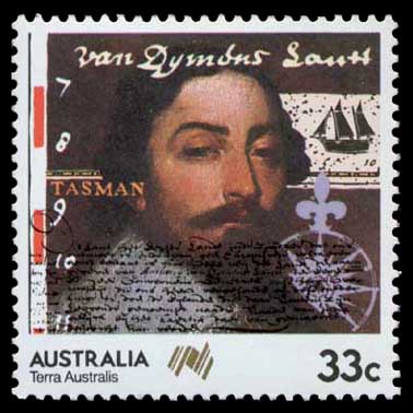
His portrait has been on four New Zealand postage stamp issues, on a 1992 5 NZD coin, and on 1963, 1966[36][unreliable source?] and 1985 Australian postage stamps.[37]
In the Netherlands, many streets are named after him. In Lutjegast, the village where he was born, there is a museum dedicated to his life and travels.
Tasman's life was dramatised for radio in Early in the Morning (1946) a play by Ruth Park.
Portraits and depictions
.jpg)
A drawing titled Abel Janssen Tasman, Navigateur en Australie is held by the State Library of New South Wales as part of "a portfolio of 26 ink drawings of 16th and 17th century Dutch admirals, navigators and governor-generals of the VOC".[38] The portfolio was acquired at an art auction in The Hague in 1862.[39] However, it is unclear if the drawing is of Tasman and its original source is unknown, although it has been said to resemble the work of Dutch engraver Jacobus Houbraken.[40] The drawing has been assessed as having the "most reliable provenance" of any depiction of Tasman with "no strong reason to doubt that the drawing is not genuine".[41]
In 1948, the National Library of Australia acquired from Rex Nan Kivell a portrait purporting to depict Tasman with his wife and stepdaughter, which was attributed to Jacob Gerritsz. Cuyp and dated to 1637.[42] In 2018 the painting was exhibited by the Groninger Museum in the Netherlands which identified it as "the only known portrait of the explorer".[43] However, the Netherlands Institute for Art History has instead attributed the painting to Dirck van Santvoort and concluded that the painting does not depict Tasman and his family.[41]
The provenance provided from Nan Kivell for the family portrait has been unable to be verified. Nan Kivell claimed that the portrait was passed down through the Springer family – relatives of Tasman's widow – and was sold at Christie's in 1877. However, Christie's records indicate that the portrait was not owned by the Springer family or associated with Tasman, and was instead sold as "Portrait of an astronomer" by "Anthonie Palamedes" [sic].[42] Nan Kivell additionally claimed that the portrait was sold at Christie's a second time in 1941, however no records exist to support this. A survey of portraits of Tasman published in 2019 concluded that the provenance was "either invented by Rex Nan Kivell or by the unnamed art dealer who sold it to Rex Nan Kivell", and that the painting "should therefore not be considered a portrait of Abel Tasman's family".[44]
Outside of the Nan Kivell painting, another purported portrait of Tasman was "discovered" in 1893 and eventually acquired by the Tasmanian government in 1976 for the Tasmanian Museum and Art Gallery (TMAG).[45] The painting is unsigned and was attributed to Bartholomeus van der Helst at the time of its discovery, but this attribution was disputed by Dutch art historian Cornelis Hofstede de Groot and Alec Martin of Christie's. In 1985, TMAG curator Dan Gregg stated that "the painter of the life-sized portrait is unknown [...] there is some uncertainty as to whether the portrait is really of Tasman".[46]
Tasman map


Held within the collection of the State Library of New South Wales is the Tasman map,[47] thought to have been drawn by Isaac Gilsemans, or completed under the supervision of Franz Jacobszoon Visscher.[48] The map is also known as the Bonaparte map, as it was once owned by Prince Roland Bonaparte, the great-nephew of Napoleon.[49] The map was completed sometime after 1644 and is based on the original charts drawn during Tasman's first and second voyages.[50] As none of the journals or logs composed during Tasman's second voyage have survived, the Bonaparte map remains an important contemporary artefact of Tasman's voyage to the northern coast of the Australian continent.[50]
The Tasman map reveals the extent of understanding the Dutch had of the Australian continent at the time.[51] The map includes the western and southern coasts of Australia, accidentally encountered by Dutch voyagers as they journeyed by way of the Cape of Good Hope to the VOC headquarters in Batavia.[49] In addition, the map shows the tracks of Tasman's two voyages.[49] Of his second voyage, the map shows the Banda Islands, the southern coast of New Guinea and much of the northern coast of Australia. However, the land areas adjacent to the Torres Strait are shown unexamined; this is despite Tasman having been given orders by VOC Council at Batavia to explore the possibility of a channel between New Guinea and the Australian continent.[50][51]
There is debate as to the origin of the map.[52] It is widely believed that the map was produced in Batavia; however, it has also been argued that the map was produced in Amsterdam.[49][52] The authorship of the map has also been debated: while the map is commonly attributed to Tasman, it is now thought to have been the result of a collaboration, probably involving Franchoijs Visscher and Isaack Gilsemans, who took part in both of Tasman's voyages.[5][52] Whether the map was produced in 1644 is also subject to debate, as a VOC company report in December 1644 suggested that at that time no maps showing Tasman's voyages were yet complete.[52]
In 1943, a mosaic version of the map, composed of coloured brass and marble, was inlaid into the vestibule floor of the Mitchell Library in Sydney.[53] The work was commissioned by the Principal Librarian William Ifould, and completed by the Melocco Brothers[54] of Annandale, who also worked on the ANZAC War Memorial in Hyde Park and the crypt at St Mary's Cathedral, Sydney.[54][48]
See also
References
- ↑ 1.0 1.1 1.2 1.3 1.4 1.5 1.6 1.7 1.8 "Story: Tasman, Abel Janszoon". Te Ara: The Encyclopedia of New Zealand.
- ↑ 2.0 2.1 Yarwood, Vaughan (March 2005). "Abel Tasman". New Zealand Geographic.
- ↑ 3.0 3.1 Template:Cite Australian Dictionary of Biography
- ↑ Andrew Sharp, The Voyages of Abel Janszoon Tasman, Oxford, Clarendon Press, 1968, p. 25.
- ↑ 5.0 5.1 J.E. Heeres, "Abel Janszoon Tasman, His Life and Labours", Abel Tasman's Journal, Los Angeles, 1965, pp. 137, 141–142; cited in Andrew Sharp, The Voyages of Abel Janszoon Tasman, Oxford, Clarendon Press, 1968, p. 24.
- ↑ "Abel Janszoon Tasman, the first known European explorer to reach Tasmania and New Zealand and to sight Fiji". robinsonlibrary.com. Archived from the original on 24 September 2015. Retrieved 31 August 2015.CS1 maint: unfit URL (link)
- ↑ 7.0 7.1 7.2 7.3 "Tasman Journal". Archived from the original on 29 August 2016. Retrieved 10 August 2016.
- ↑ "Monumenta cartographica [cartographic material] : reproductions of unique and rare maps, plans and views in the actual size of the originals : accompanied by cartographical monographs | Original map of Tasmania in December 1642". Archived from the original on 29 June 2011. Retrieved 31 August 2015 – via National Library of Australia.
- ↑ Burney, J (1813) A Chronological History of the Voyage and Discoveries in the South Sea of Pacific Ocean L Hansard & Sons, London, p. 70, cited in Potts, B.M. et al. (2006) Janet Sommerville's Botanical History of Tasmania University of Tasmania and TMAG
- ↑ 10.0 10.1 Beazley 1911.
- ↑ Schilder, Günter (1976). Australia unveiled : the share of the Dutch navigators in the discovery of Australia. Amsterdam: Theatrum Orbis Terrarum Ltd. p. 170. ISBN 9022199975.
- ↑ Valentyn, Francois (2003) [1724–1726]. Oud en nieuw Oost-Indien. Dordrecht: J. van Braam. p. vol. 3, p. 47. ISBN 9789051942347.
- ↑ Cameron-Ash, M. (2018). Lying for the Admiralty. Sydney: Rosenberg. p. 105. ISBN 9780648043966.
- ↑ "A view of the Murderers' Bay – History – Te Ara: The Encyclopedia of New Zealand". teara.govt.nz. Archived from the original on 5 December 2012. Retrieved 31 August 2015.
- ↑ "European discovery of New Zealand". Encyclopedia of New Zealand. 4 March 2009. Archived from the original on 10 November 2010. Retrieved 9 December 2010.
- ↑ John Bathgate. "The Pamphlet Collection of Sir Robert Stout: Volume 44. Chapter 1, Discovery and Settlement". NZETC. Archived from the original on 24 July 2020. Retrieved 17 August 2018.
He named the country Staaten Land, in honour of the States-General of Holland, in the belief that it was part of the great southern continent.
- ↑ Tasman, Abel. "Journal or Description by me Abel Jansz Tasman, Of a Voyage from Batavia for making Discoveries of the Unknown South Land in the year 1642". Archived from the original on 8 October 2020. Retrieved 26 March 2018 – via Project Gutenberg Australia.
- ↑ Wilson, John (March 2009). "European discovery of New Zealand – Tasman's achievement". Te Ara: The Encyclopedia of New Zealand. Archived from the original on 6 January 2012. Retrieved 24 January 2011.
- ↑ Lane, Kris E. (1998). Pillaging the Empire: Piracy in the Americas 1500–1750. Armonk, N.Y.: M.E. Sharpe. p. 88. ISBN 978-0-76560-256-5.
- ↑ Kock, Robbert. "Dutch in Chile". Colonial Voyage.com. Archived from the original on 29 February 2016. Retrieved 23 October 2014.
- ↑ Barros Arana, Diego (2000) [1884]. Historia General de Chile (in Spanish). IV (2 ed.). Santiago, Chile: Editorial Universitaria. p. 280. ISBN 956-11-1535-2. Archived from the original on 31 August 2019.
- ↑ Tasman, Abel Jansz. The Huydecoper Journal, 1642–1643. Sydney: Mitchell Library, SLNSW. p. 43.
- ↑ Cameron-Ash, M. (2018). Lying for the Admiralty. Sydney: Rosenberg. pp. 21–22. ISBN 9780648043966.
- ↑ Mack, Rudiger (2024). First Encounters. The Early Pacific and European Narratives of Abel Tasman's 1642 Voyage. Feilding, New Zealand: Heritage Press. pp. 47–49. ISBN 9781991097002.
- ↑ 25.0 25.1 Moon, Paul (2013). Turning Points. New Holland. p. 19. ISBN 978-1-86966-379-7.
- ↑ Diary of Abel Tasman pp. 21–22. Random House. 2008
- ↑ Barber, Ian (2012). "Gardens of Rongo: Applying Cross-Field Anthropology to Explain Contact Violence in New Zealand". Current Anthropology. University of Chicago Press. 53 (6): 799–808. doi:10.1086/667834. ISSN 0011-3204.
- ↑ 28.0 28.1 Quanchi, Historical Dictionary of the Discovery and Exploration of the Pacific Islands, p. 237
- ↑ "Abel Tasman's great voyage". Tai Awatea-Knowledge Net. Archived from the original on 25 April 2012. Retrieved 14 September 2011.
- ↑ Whitmore, Robbie. "Abel Janszoon Tasman – New Zealand in History – Holland 1603–1659". history-nz.org. Archived from the original on 22 October 2018.
- ↑ A translation of part of Visscher's memoir may be read on pp. 24–27 of Andrew Sharp, The voyages of Abel Janszoon Tasman, Oxford: Clarendon, 1968, p. 82, n. 1.
- ↑ Nationaal Archief, Den Haag, Aanwinsten Eerste Afdeling, nummer toegang 1.11.01.01, inventarisnummer 121
- ↑ Sharp, Andrew (1968). The Voyages of Abel Janszoon Tasman. Clarendon Press. pp. 25–30. ISBN 978-0198213765.
- ↑ Cameron-Ash, M. (2018). Lying for the Admiralty. Rosenberg. pp. 21–22. ISBN 9780648043966.
- ↑ "HMNZS Tasman".
- ↑ "Stamporama Discussions: 1963 4/- & 1966 40 cent Tasman and his ship the "Heemskerk"". stamporama.com. Archived from the original on 21 December 2019. Retrieved 7 February 2023.
- ↑ "Image: 0015370.jpg, (378 × 378 px)". australianstamp.com. Archived from the original on 23 September 2015. Retrieved 31 August 2015.
- ↑ Mack 2019, p. 47.
- ↑ Mack 2019, p. 48.
- ↑ Mack 2019, p. 49.
- ↑ 41.0 41.1 Mack 2019, p. 61.
- ↑ 42.0 42.1 Mack 2019, p. 58.
- ↑ "Portrait of Abel Tasman in Groningen". Groninger Museum. Retrieved 1 August 2024.
- ↑ Mack 2019, pp. 59–60.
- ↑ Mack 2019, pp. 53–55.
- ↑ Mack 2019, p. 56.
- ↑ "MAP | Carten dese landen Zin ontdeckt bij de compangie ontdeckers behaluen het norder deelt van noua guina ende het West Eynde van Java dit Warck aldus bij mallecanderen geuoecht ut verscheijden schriften als mede ut eijgen beuinding bij abel Jansen Tasman. Ano 1644 dat door order van de E.d.hr. gouuerneur general Anthonio van diemens [cartographic material] : [Bonaparte Tasman map]". State Library of New South Wales. Retrieved 28 April 2022. Tasman, Abel Janszoon, 1603?–1659. : 1644.|
- ↑ 48.0 48.1 "The tasman map". Discover Collections. State Library of New South Wales. 2012.
- ↑ 49.0 49.1 49.2 49.3 Hooker, Brian N. (November 2015). "New Light on the Origin of the Tasman-Bonaparte Map". The Globe (78). Archived from the original on 4 July 2021. Retrieved 8 August 2016 – via Informit.
- ↑ 50.0 50.1 50.2 Patton, Maggie (2014). "Tasman's Legacy". In Pool, David (ed.). Mapping our world : Terra Incognita to Australia. Canberra. pp. 140–142. ISBN 9780642278098.
- ↑ 51.0 51.1 Jeans, D.N. (1972). Historical Geography of New South Wales to 1901. Reed Education. p. 24. ISBN 0589091174.
- ↑ 52.0 52.1 52.2 52.3 Anderson, G (2001). The Merchant of the Zeehaen: Isaac Gilsemans and the voyages of Abel Tasman. Wellington: Te Papa Press. pp. 155–158. ISBN 0909010757.
- ↑ "Tasman Map in the Mitchell Vestibule". State Library of NSW. 28 January 2016. Retrieved 7 February 2023.
- ↑ 54.0 54.1 Template:Cite Australian Dictionary of Biography

Sources
- Template:Dictionary of Australian Biography
- Edward Duyker (ed.) The Discovery of Tasmania: Journal Extracts from the Expeditions of Abel Janszoon Tasman and Marc-Joseph Marion Dufresne 1642 & 1772, St David's Park Publishing/Tasmanian Government Printing Office, Hobart, 1992, pp. 106, ISBN 0-7246-2241-1.
- Lua error in Module:Cite_Q at line 13: attempt to index a nil value.
- Mack, Rüdiger (2019). "New light on the portraits of Abel Tasman". The Great Circle. Australian Association for Maritime History. 41 (2): 46–64. JSTOR 26910735.
- Quanchi, Max (2005). Historical Dictionary of the Discovery and Exploration of the Pacific Islands. The Scarecrow Press. ISBN 0810853957.
- Beazley, Charles Raymond (1911), , in Chisholm, Hugh (ed.), Encyclopædia Britannica, 26 (11th ed.), Cambridge University Press, pp. 437–438
- Mack, Rudiger (2024), First Encounters: The Early Pacific and European Narratives of Abel Tasman's 1642 Voyage.[1] Feilding, New Zealand: Heritage Press. ISBN 978-1-991097-00-2
External links
- File:Commons-logo.svg Media related to Abel Tasman at Wikimedia Commons
- Template:BHL author
- Template:OL author
- Script error: No such module "Internet Archive".

- CS1 Spanish-language sources (es)
- Use dmy dates from June 2023
- Use British English from August 2024
- Articles with hCards
- Articles needing additional references from November 2018
- Articles lacking reliable references from July 2023
- Wikipedia articles incorporating a citation from the 1911 Encyclopaedia Britannica with Wikisource reference
- 17th-century Dutch explorers
- 1603 births
- 1659 deaths
- Dutch explorers of the Pacific
- Explorers of Australia
- Explorers of New Zealand
- Explorers of Tasmania
- People from Grootegast
- Sailors on ships of the Dutch East India Company