File:Mitchell map michigan.jpg
Jump to navigation
Jump to search
Original file (2,356 × 2,366 pixels, file size: 5.97 MB, MIME type: image/jpeg)
Summary
| Description |
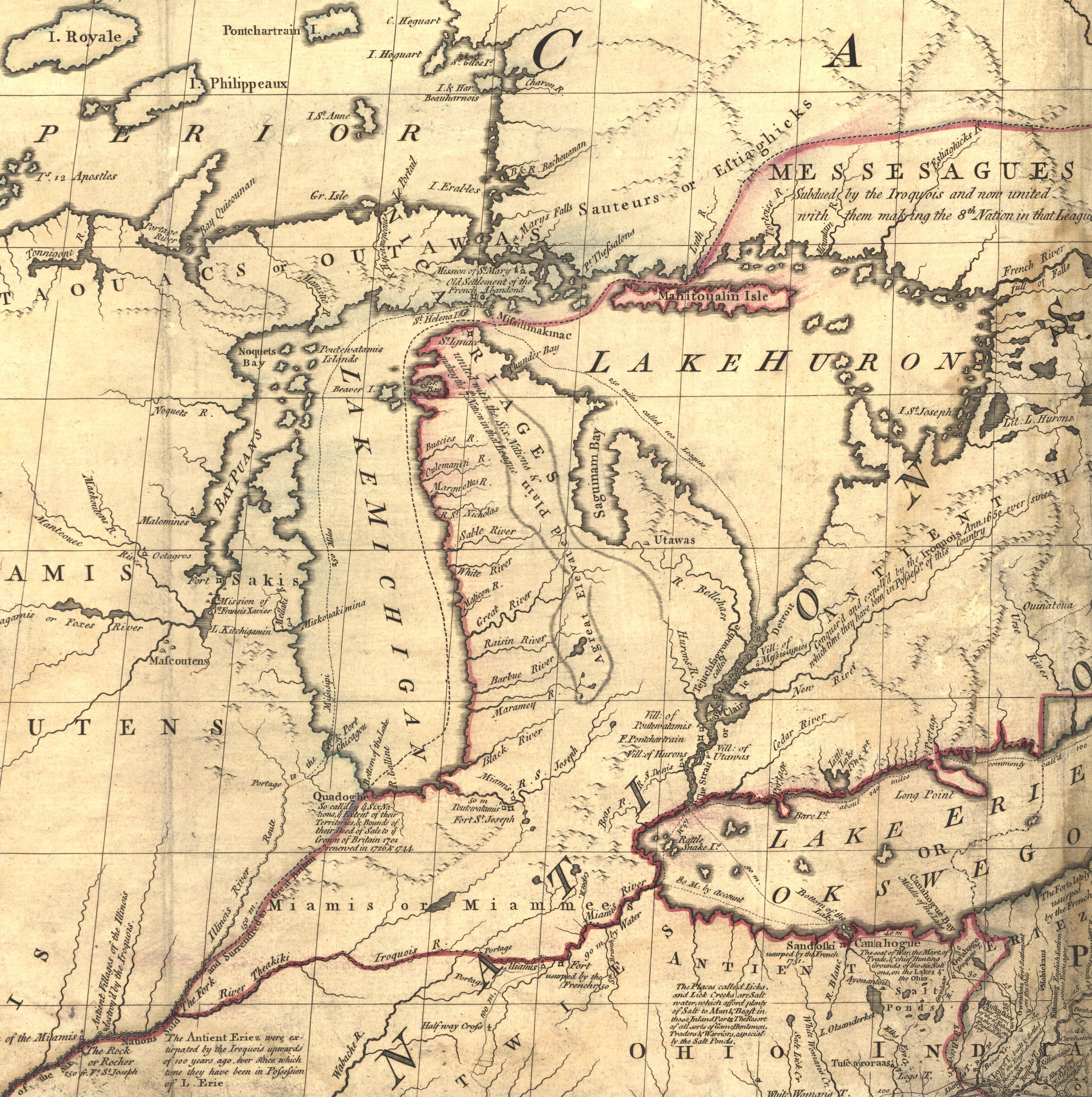
English: Excerpt from the Mitchell Map, a circa 1757 map of the United States by botanist and cartographer John Mitchell, centered on the Lower Peninsula of Michigan. The inaccuracy of this map is one of the factors that led to the Toledo War of 1835-1836. |
|||||||||||||||||||
| Date | between 1755 and 1757 | |||||||||||||||||||
| Source |
|
|||||||||||||||||||
| Author |
|
|||||||||||||||||||
| Other versions | ||||||||||||||||||||

Licensing
|
The author died in 1768, so this work is in the public domain in its country of origin and other countries and areas where the copyright term is the author's life plus 100 years or fewer. This work is in the public domain in the United States because it was published (or registered with the U.S. Copyright Office) before January 1, 1931. | |
| This file has been identified as being free of known restrictions under copyright law, including all related and neighboring rights. | |
| This work is from the Library of Congress. According to the library, there are no known copyright restrictions on the use of this work. |  |
Original upload log
The original description page was here. All following user names refer to en.wikipedia.
- 2006-05-03 00:35 Hotstreets 258×277×8 (28294 bytes) Mitchell Map of Michigan region from late 1700s. Public domain, since an image of a public domain image is also public domain. Found on [http://www.usm.maine.edu/~maps/mitchell/full2.jpeg].
File history
Click on a date/time to view the file as it appeared at that time.
| Date/Time | Thumbnail | Dimensions | User | Comment | |
|---|---|---|---|---|---|
| current | 22:53, 4 July 2016 | No thumbnail | 2,356 × 2,366 (5.97 MB) | commonswiki>JasonAQuest | Cropped from file:Mitchell_Map-06full2.jpg |
File usage
The following file is a duplicate of this file (more details):
- File:Mitchell map michigan.jpg from Wikimedia Commons
The following page uses this file: